Flying site / Site de vol
Elsinore, California, USA
Jérôme Daoust
( E-mail )
2024/11/6
-
Conditions
-
The club supporting the site / Le club supportant le site:
The "E" Team,
HG > Wiki > Elsinore.
-
Events / Evénement:
None.
-
Bulletin board / Tableau d'affichage:
None.
-
Articles
-
Schools / Ecoles
-
Lost and Found / Object perdu ou retrouvé:
No info.
-
How to get there / Comment s'y rendre:
-
Maps / Cartes
-
GPS coordinates / Coordonnées GPS
-
Site frequency / Fréquence du site:
144.120 .
-
Insurance / Assurances
-
Lodging / Hébergement
-
Restaurant:
No info.
-
Car rental / Location d'auto:
No info.
-
Image
-
Video or Animation / Vidéo ou Animation
-
Cross Country / Vol Voyage
-
Hazards / Dangers
Conditions
We are hoping for North-East (45 degree) winds and for the on-shore breeze
to create a convergence at mid day.
By order of interest:
-
Forecast:
-
Windgram, for wind direction and altitude ceilings:
Soaring Predictor
(click "Elsinore",
Archive).
Understanding "Wind Barbs".
Alternate website(s):
FlyMarshall.
-
RASP (Regional Atmospheric Soaring Predictor) for Southern California:
Soaring Predictor
(Older version).
Typical sequence:
-
Select day and time.
-
Select a parameter like "Sfc.Wind (10m)".
-
To change the opacity of the data layer:
Click the "+" or "-" icons in lower right
(Old version: Use slider in the upper right, or mouse's center wheel).
-
Finding flying sites:
Click the layer icon in the upper right, enable the "Sounding/SkewT".
Hover your mouse pointer over the markers, names appear.
Alternate website(s):
FlyMarshall.
-
Soaring Predictor
(updated daily at 7:30 AM).
-
Lake Elsinore forecast (Weather Underground):
Hourly,
10 days.
-
Lake Elsinore forecast (Weather.com):
Hourly,
15 days.
-
Look for a fire nearby (associated air traffic):
-
Look for a TFR (Temporary Flight Restriction):
-
SkyVector.
-
SoaringData. Transforms local TFRs into a KML file for visualization in Google Earth:
-
Center airport identifier: sbd (San Bernardino International)
-
Bounding radius (stat. miles): 100
-
Airspace in Google Earth KML format
-
Append special use and ATC-controlled airspace uncheked
-
Type "Soar" into this box: Soar and press Submit
-
SoarCal / TFR. Click the map icon to visualize the TFR over a map.
-
FAA / TFR. Set "State" to "California", then click "GO" next to it.
-
Current:
Articles
Schools / Ecoles
for paragliding operating at this site.
Ordered alphabetically / Ordonné alphabétiquement:
Maps / Cartes
GPS coordinates / Coordonnées GPS
| Description |
Latitude |
Longitude |
Altitude (ASL) |
| E launch |
N 33° 37.789' |
W 117° 22.287' |
871 m (GPS*) |
2857' (GPS*) |
| Edwards launch (closest to LZ) |
N 33° 38.307' |
W 117° 23.231' |
850 m (GPS**) |
2788' (GPS**) |
| Grand Ave LZ (as of 2019) |
N 33° 39.545' |
W 117° 22.687' |
398 m (GPS**) |
1305' (GPS**) |
| Marina LZ (as of 2008) |
N 33° 39.960' |
W 117° 22.620' |
380 m (GPS**) |
1246' (GPS**) |
| Everyday Mike's LZ (as of 2008) |
N 33° 37.980' |
W 117° 20.700' |
412 m (GPS**) |
1351' (GPS**) |
| Oak tree LZ (In litigation as of 2018, DO NOT LAND THERE) |
N 33° 39.026' |
W 117° 22.602' |
448 m (GPS**) |
1469' (GPS**) |
* GPS = Br�uniger / Competino, using WGS84.
WGS84 (World Geodetic System 1984) is the Standard Geodetic Datum & the common reference datum
used for civilian aviation world wide.
More info:
Mean Sea Level, GPS, and the Geoid.
** Google Earth.
*** Reported GPS altitude, to be verified.
For a great way to explore this flying site in 3D,
see Google Earth's Local points of interest in the
Maps section.
Insurance / Assurances
-
You will need to become a USHPA member and it's not expensive
for the 1 month membership.
Just contact one of the
Schools
so you can take the one month membership for 10$.
It is good all over the US for the 30 day period.
-
Tu devras devenir un membre de l'USHPA et ce n'est pas cher
pour être membre pour un mois.
Tu as juste à contacter une des
Ecoles
afin de prendre le membersip d'un mois pour 10$.
Ce sera bon pour tous les sites aux Etats-Unis pour une
période de 30 jours.
Lodging / Hébergement
Image
Pictures I took (click thumbnail to open full size image in a new window)
Photos que j'ai prises (clique la petite image pour ouvrir la photo pleine grandeur dans une nouvelle fenêtre)
|
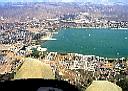
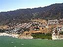
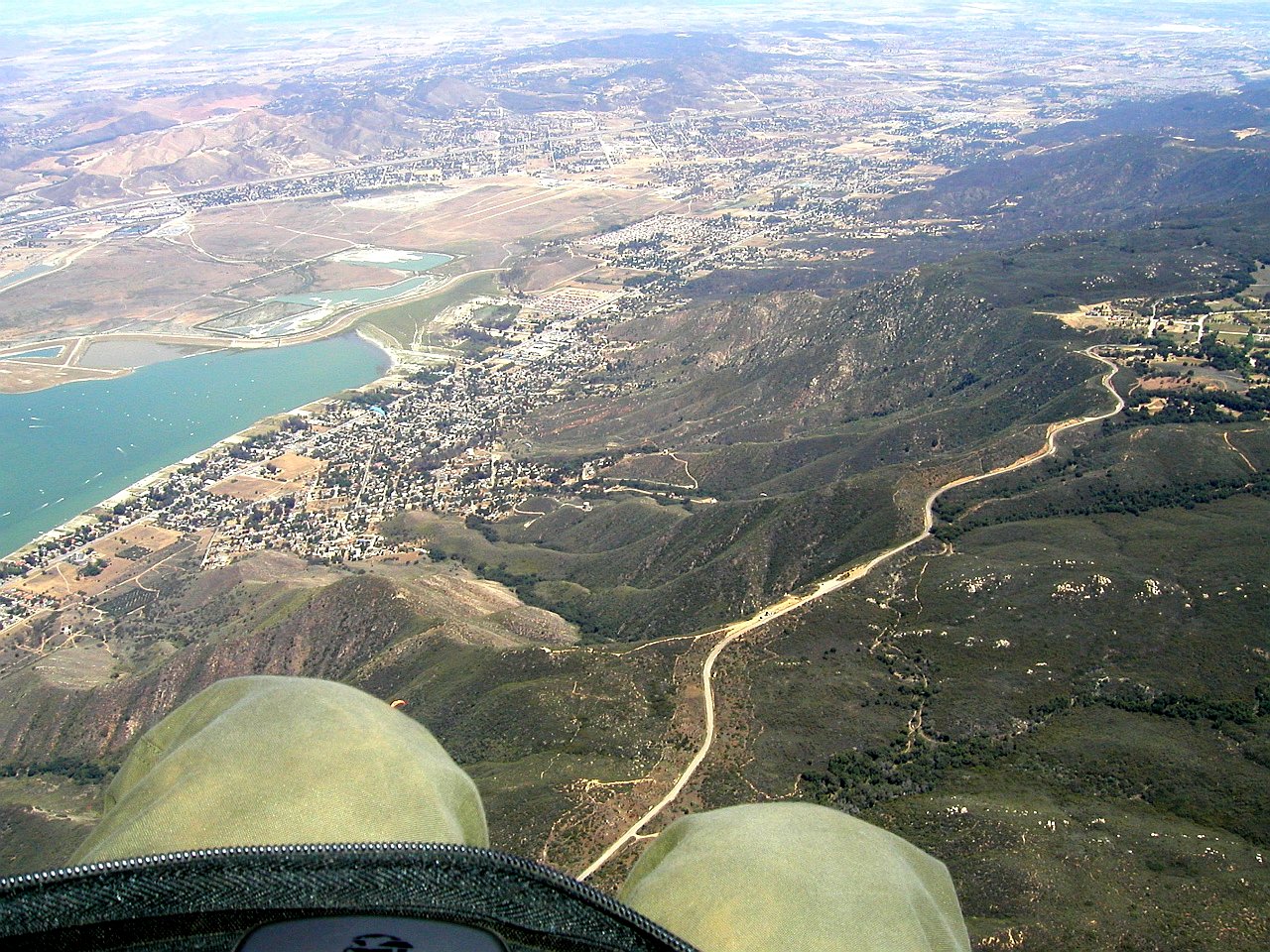
2006/7/1
|
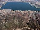
At 8000' and looking down at launch, and the LZ.
|
|
A 8000' et regardant en bas au décollage et l'atterrissage.
|
|
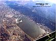
2006/7/1
|
At 8000' at looking at the Pacific ocean.
|
|
A 8000' and regardant vers l'océan Pacifique.
|
|
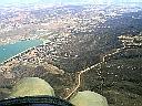
2006/7/1
|
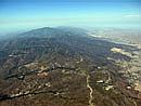
At 8000' and looking North at Santiago Peak (6k).
|
|
A 8000' et regardant Santiago Peak (6k) au Nord .
|
|
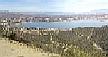
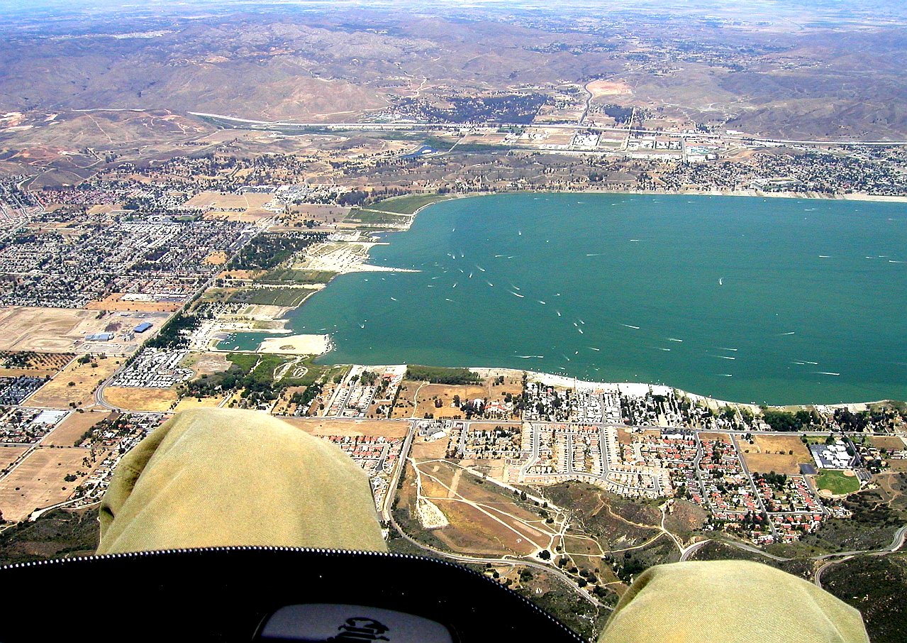
2006/7/1
|
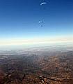
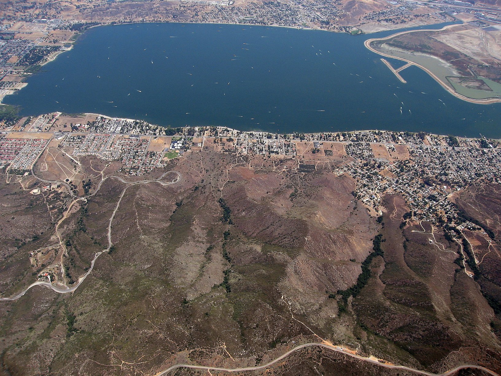
Going XC to the East and looking back at Elsinore from Quail Valley.
|
|
En vol voyage vers l'Est et regardant Elsinore derrière depuis Quail Valley.
|
Pictures/Images from others (click thumbnail to open full size image in a new window)
Photos/Images des autres (clique la petite image pour ouvrir la photo pleine grandeur dans une nouvelle fenêtre)
 80 kB
80 kB
|
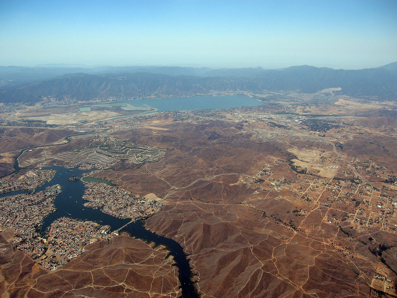
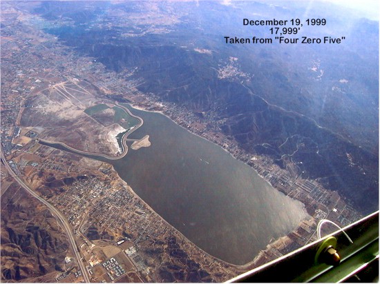
1999/12/19
|
Picture by an E teamer, taken from 17999'.
|
|
Photo par un membre du E team, prise depuis 17999'.
|
 966 kB
|
2002/2
|
360° panorama of "Edwards" launch.
QuickTime required.
Click and drag the left mouse button to change the view.
Thanks to "Thermal Dynamics".
|
|
Panorama 360° du décollage "Edwards".
QuickTime requis.
Clique et traîne le bouton gauche de la souris pour changer le point de vue.
Merci à "Thermal Dynamics".
|
 435 kB
|
2004/5/2
|
Over the E launch. Picture by Bob Barry.
|
|
Au dessus du décollage E. Photo par Bob Barry.
|
 444 kB
|
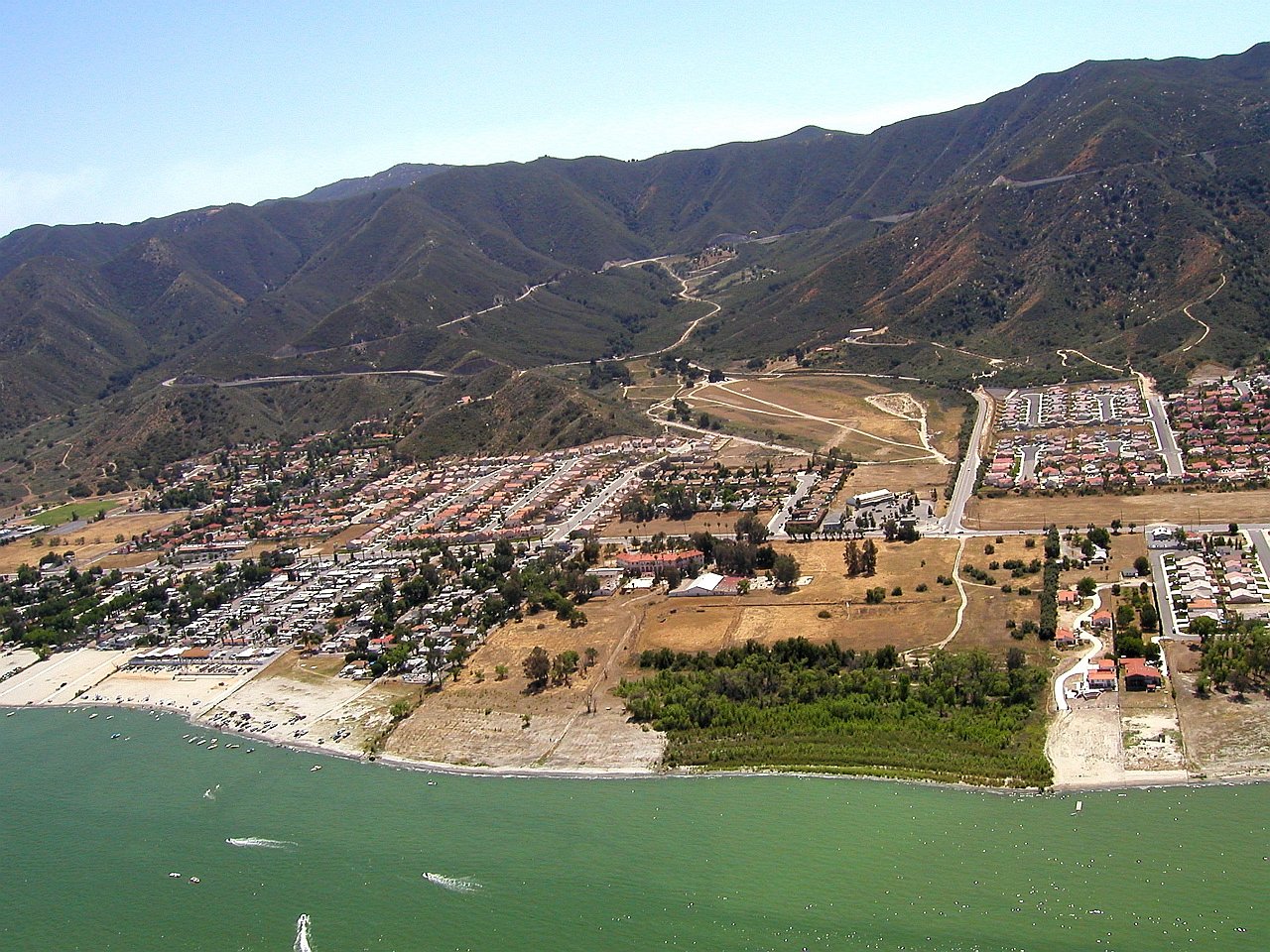
2004/5/2
|
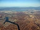
The LZ is in the bottom of the picture. Picture by Bob Barry.
|
|
L'atterrissage est au bas de la photo. Photo par Bob Barry.
|
 380 kB
|
2004/5/2
|
The LZ from the lake. Picture by Bob Barry.
|
|
La zone d'atterrissage depuis le lac. Photo par Bob Barry.
|
Video or Animation / Vidéo ou Animation
Cross Country / Vol Voyage
Before you go, know your airspace. For Google Earth:
California 3D overlay for classes B/C/D and restricted military airspace.
Hazards / Dangers
-
-
Short launch.
Reaching the LZ from the "E" launch will require some lift
(easier from the "Edwards" launch).
-
Décollage court.
Pour rejoindre l'atterissage depuis le décollage "E"
il faut de l'ascendance
(plus facile depuis le décollage "Edwards").
-
-
Bill Soderquist, 2002/3/3:
Northerly wind conditions are known to create a rotor
on the south side of the spine at the "E"
and is usually referred to as the Tuck Zone by the locals.
During Santa Ana conditions, most pilots launch from "Edwards" Bowl
because of the favorable conditions when it is North.
-
Bill Soderquist, 2002/3/3:
Les vents du Nord créent un rotor du côté Sud
de l'épine au décollage "E"
et est désigné comme le Tuck Zone (Zone de Fermeture) par les locaux.
Durant les conditions de Santa Ana, la plupart des pilotes
décollent depuis le bol "Edwards"
à cause de ses conditions favorables quand c'est Nord.

 80 kB
80 kB
 435 kB
 444 kB
 380 kB