Back to Marshall : Cross Country / Vol Voyage
The Dam Race
Organizer : Mike Masterson, E-mail at home, work (Tuesday to Friday), Home page.
1. 2001/5/26
2. 2001/6/9
3. 2001/7/14
4. 2001/9/2
5. 2001/9/30
6. 2001/11/11. Final (3rd) race attempt failed (bad weather). End of this year's series.
1. Race is open to HG and PG pilots (separate categories). Amongst PG, there is a DHV 1-2 class (includes DHV 1 wings) and an open class (any DHV level).
2. Radio frequency of 146.415
3. Mike Masterson :
· 2001/5/25 : The way I see it is that we can have entrants launching both Crestline and Marshall, providing that updates are announced over the radio. I will be up on Marshall launch at about noon, taking names of each competitor. The guys wishing to launch Crestline can tell me their name over the radio and pay the entry fee later. I would suggest that all PG's launch Marshall... Crestline will be an option for any HG's who wish to launch up there. HG's can launch Marshall if they wish, I just have no idea how much traffic will be occurring during the launch window, which should be happening sometime between 12:45 and 1:30. I anticipate a start time around 1:15 if people are getting well above Marshall. This thing may not run perfectly, but the concept is simple, Just a race to the Dam, with the start called over the Radio and finishers or people at the dam will record and call out the finishing order over the radio. The finish line will be when you touchdown in the wash just downwind of the bridge. My truck will be going to the dam with a driver to be able to do some retrieves, but I can't guarantee that all stray land outs will be picked up immediately. You may need to hike out to the main roads like Highland and then try to arrange a ride back or wait for the final truck. People flying in a group should probably have a driver with a radio and map to insure that they get picked up. A good source of drivers is novices that can't fly during the midday.
· 2001/6/5 : We will probably start around 2:00. People should probably show up around 1:00 though. No real sign-ins. We didn't do it last time. The $5 entry fee will go towards the retrieval ride back. So in other words, no need to pay up front, but please plan on giving $5 towards the vehicle that drives you back from your XC. It is going to be totally informal, when you see me launch, plan on the start being about 15 minutes later. No cash prizes this time but there will be beer in my truck for any participants that want it. Finish points will go towards the series. If we have around 10 entrants then the points will be 10-8-6-4-2-1. If we have nearly 20 entrants, then the points will be doubled. (This makes a race with more pilots, have more value). Radios and cell phones are suggested for those pilots who wish to get picked up by the retrieval truck instead of the coyotes and turkey vultures.
· 2001/10/2 : Regarding the points, anyone who lands in the same basic field, short of goal get the same points but if a pilot flies further towards goal by one or more main streets, then they get a better position and the additional points. Gliding 100 feet further then another pilot and impaling yourself on a fence post won't get you anything but a Mike’s Hard Lemonade and the same points as the guy who landed in the center of the same field. Here is another idea, which may come into play: "Out of Bounds". Anyone who gets blown over the back of the mountain range will be considered "out of bounds" and must take a two-stroke penalty prior to re-launching. Finish time will be recorded when you fly over the Santa Ana River near the bridge and not when you land. The Winner should get a trophy made from a chunk of the dam glued to a plaque with a brass plate that says: "I survived numerous Gust Fronts, Massive Killer Cumulonimbus, Many dust devils, beat some of the best pilots in the US over a 6 race series and All I got was this lousy plaque".
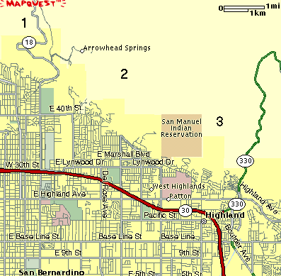
4. Ken Howells : Be aware also that the pale plum colored area just south of San Manuel Indian Reservation is Patton State Hospital (nuthouse, booby hatch, loony bin). There are a couple of large fields at the north end of the grounds, adjacent to the Middle School grounds. The officials haven't been hostile when people have landed there in the past, but it's a spot best avoided.
5. Jerome Daoust : Avoid landing in the Indian Reservation (between points 2 and 3) as the recovery vehicle requires police escort to enter the reservation. We did this once to recover a pilot who could not hook up to a thermal at point number 3. He could have walked out, but we had a friend with connections that allowed us to enter to retrieve him (still with a police escort). This is a classical scenario : After covering the foothill (point 2) you typically arrive low to point 3. Failure to catch a thermal will make you scratch until you can barely exit the Indian reservation. Just expect to walk out of the reservation if you land in there.
6. Mike Miller : I stopped at the LZ next to the bridge, in front of the Santa Ana river dam, on my ride home. My GPS showed these distances at the bridge -- Marshall 13.4 and Crestline launch 15.0 .
(thanks to Rob McKenzie of High Adventure)
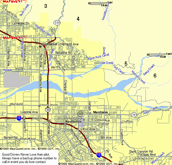
Road maps (to help recovery) :
Pictures
(Most available in higher-resolution, upon request)
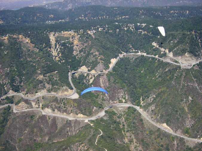
A good gaggle set up before starting the race on 2001/9/2. Blue Area/Rebel with Mike Masterson and White Windtech/Quarx with Tom Moock. We are at 6000'.
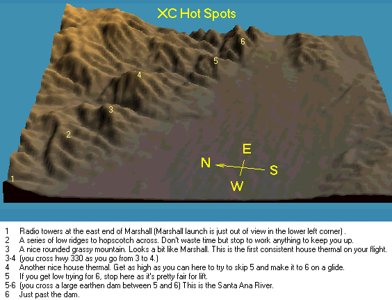
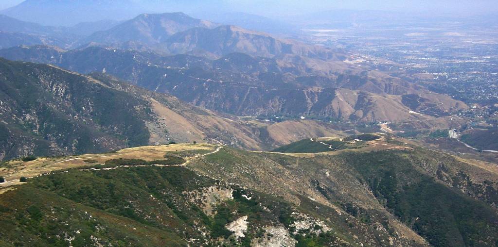
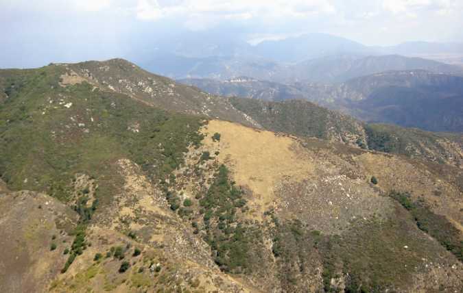
From Marshall (at about 5000') and looking East. We see the Radio Towers (#1), Low Ridges (#2), Mountains for points #3 and #4. I took this picture on 2001/6/30 and increased the contrast to cut through the haze.
On glide to point #3, after catching a good thermal in front of the foothills. 2001/9/2.
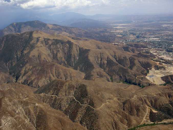
Thermalling before point #3. 2001/9/2.
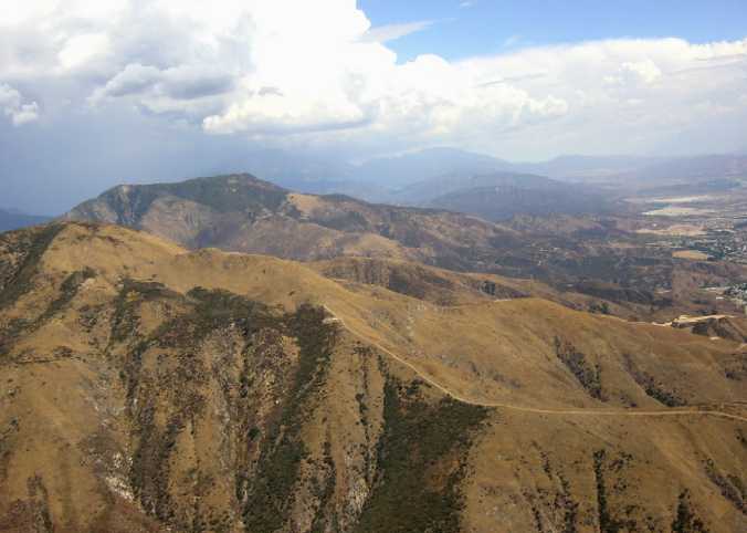
Thermalling before point #4. 2001/9/2. Turbulent air is often encountered if one ventures immediately to the East of this peak.
On glide to goal from point #4. Altitude of 6500'. 2001/9/2.
Approaching goal. Notice André which is 30 seconds ahead in the upper left (Dam !). 2001/9/2.
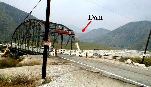
Goal (river bed next to the bridge), by Mike Masterson :
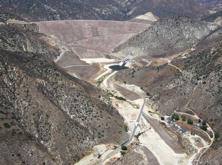
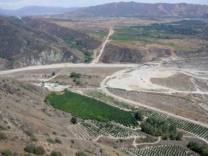
The Dam viewed from above goal, at 4100'. 2001/9/2.