Back to Marshall : Cross Country / Vol Voyage
March 20, 2004 : Crestline à Dam à Marshall
by Jérôme Daoust.
This page is focused on decisions. Good decisions are one of the most important things in XC flying. I'm trying to get better at it myself. Sharing my decisions process will help me through feedback from this page, and possibly help others by knowing what goes through someone else's head.
Mindset.
I had no particular ambitions for the day. Just to go out and fly with friends.
Previous experience.
Went to
the
·
Gain of 600 m (2000') above
· Thermal are not too rough at the edges : The flight will be relaxing, low saves will not be too trashy.
· Tailwind component during flight (some West).
But the
above conditions are not a requirement.
In a previous flight, I reached the dam without getting significant
altitude over
·
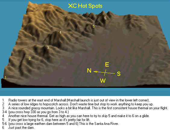
The toughest part of the Marshall à
Dam route is the first half, as the pilot has to cross a distance of low foothills
before reaching the first predictable climb after Marshall, which is at Mt
McKinley, behind the San Manuel Indian reservation (close to location #3 in
maps below). It is best to optimize
altitude and sacrifice speed during this first part. Typical sink out area is the Indian reservation where I have been
escorted out twice before, from the reservation police with a warning to avoid
the area.
|
Maps |
|
|
|
|
|
|
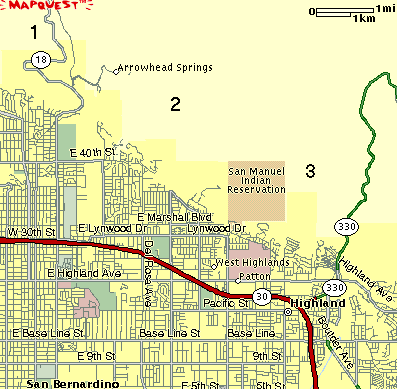
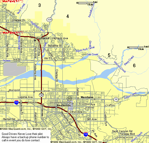
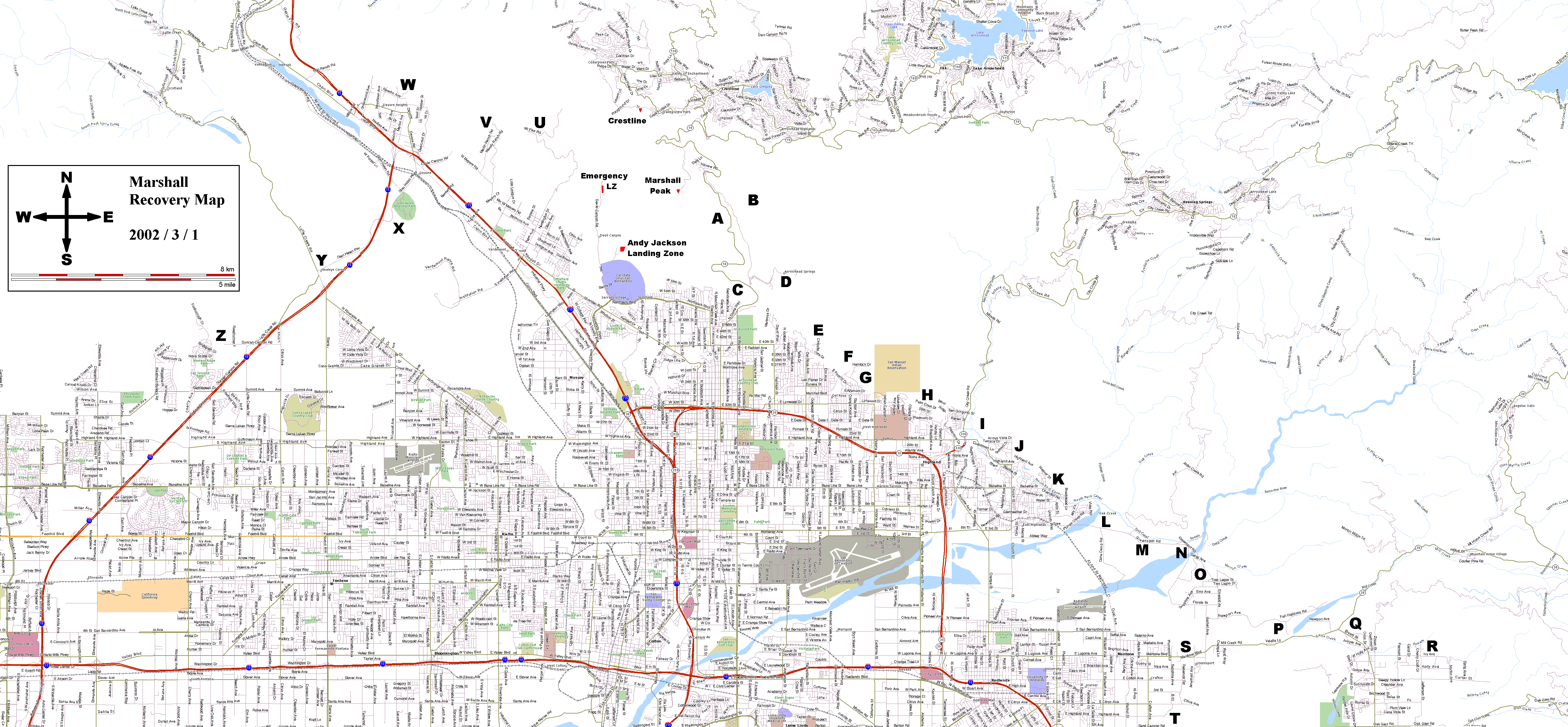
This recovery map has come in handy in the past, to facilitate retrieval : Recovery road map (625 kB). Printing on 11"x17" sheets, will produce fine print but will still have readable street names.
Morning forecast.
I gathered the following info at 9 am :
1. Weather.com was predicting mostly sunny afternoon, with 8 mph West wind in middle of the afternoon.
2.
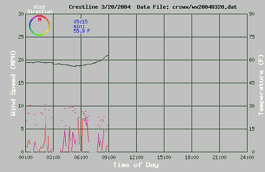
Weather
station Harvey, was showing light (gusts less than 10 mph) North wind and
decreasing. It had been blowing lightly
from the North during the night, helping to clear the valley of its typical
haze. Such conditions often lead good
days as the sun's heating can have direct access to the base of the
mountain. The risk is that it keeps
blowing from that direction during the day, so I was hoping the convection and
typical on-shore flow would take over and allow for flying.
3.
Rob McKenzie posted his daily forecast confirming my
hopes :
Saturday Mar 20th : The morning
north trickle should swing around to upslope later in the morning for an
afternoon of flying at Crestline.
4. This link showed predicted light West wind for the afternoon : Surface wind speed and direction, at 3-hour intervals – NOAA.
Confidence was at 70% that
Crestline launch.
The plan.
During the drive up, I notice the unusually clear
air near the mountains, with only a low valley haze pushed out in front. This triggered memories of previous epic
days. The clean air was a consequence
of the North wind blowing from the desert (over the back) overnight. Dusty
The reality.
Strong thermals at Billboard (East end of
Crestline ridge), too much for my taste.
I decide to maximize current lift and head forward to
Boating around
The plan.
Having reached
The reality.
Dusty Rhodes and Richard Smith (both flying paragliders) join me and fly in the area. We get altitudes similar to those at Crestline. I join Dusty in a thermal at the limit of the valley and the foothills, get height, then go towards Richard, which is getting significant lift near Cloud.
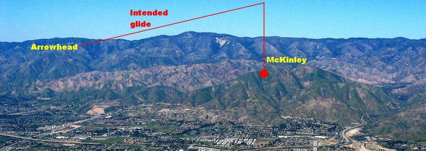
Cloud : The first big climb.
The plan.
Big climb from Cloud peak and I hear Stan
Koszelak on the radio say he is passing 8000' (2440m) MSL and having fun at
Strawberry peak. Stan says later he
reached 9000' and is heading East. I
keep climbing with a little drift towards Crestline until I reach 8800' (2683
m) MSL. I plan to head East and reach
the Dam. My first objective is to glide
to Arrowhead mountain, then maximize altitude to cross the low foothills
before Mt McKinley.
|
Picture and caption from Rod Clark (his report for that day). |
|
|
|
In this picture, you can see the shear
line. The moist, hazy sea breeze was
pushing north into |
The reality.
During the glide I put my gloves on. Flying over Arrowhead, I find no lift and
decide to push on along my east route.
Altitude is being lost fast.
Even without a GPS I feel that I am battling a light East wind
component. This is confirmed later :
|
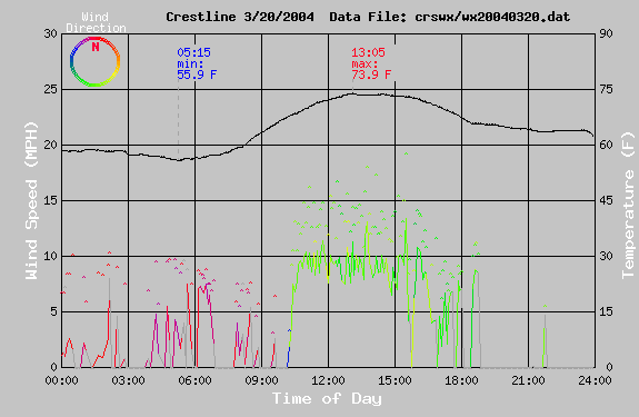
Weather station Harvey snapshot for the day |
|
|
|
The yellow-green color reveal some East wind component between 11 am and 4 pm. |
Now below
Low save in the foothills.
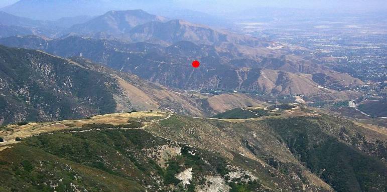
The plan.
|
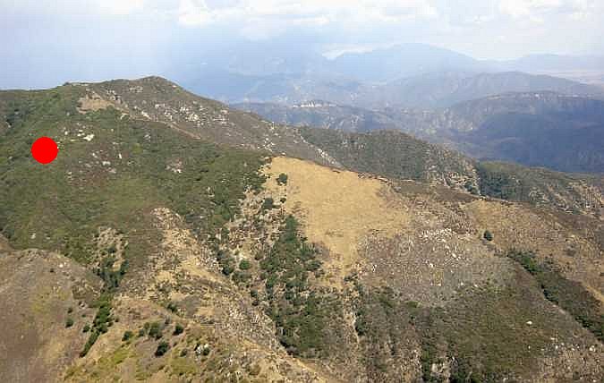
Near the back of the first significant foothill spine, I find some light lift. The red dot marks the location. |
|
|
|
Picture taken previously by myself on 2001/6/30. |
Slow climb, averaging about 1 m/s (180 fpm). I climb high enough that I could glide to McKinley (first real mountain) to about 2/3 its height over the valley, and hope to get a solid climb. Lift along the way would facilitate the connection.
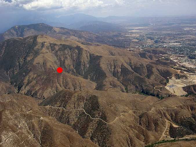
The reality.
|
I use half speed bar during extended period to counter heaving sink and what seems like a light headwind. I find solid lift in the valley before McKinley, a little before the red dot in this picture. |
|
|
|
Picture taken previously by myself on 2001/9/2. |
It now occurs to me that the best lift would be to the West of main features, as the Sun is heating more this side, and it is also slightly more protected from the light East wind component : Lee-side thermals. The good news is that the first (and difficult) half of the course is now done.
McKinley.
The plan.
A climb over McKinley, puts the next mountain
summit (
The reality.
Easy glide to
The plan.
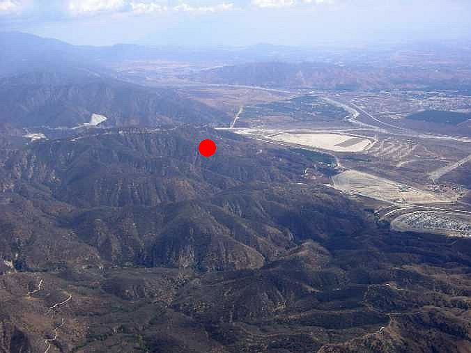
|
I find lift on the West face of the peak, shown by the red dot in this picture. |
|
|
|
Picture taken previously by myself on 2001/9/2. |
I could glide to the
The reality.
More extended periods of half speed bar use. Glide towards the base of the dam remains
feasible.
|
I find lift over the foothills before the dam, shown by the red dot in this picture. |
|
|
|
Picture taken previously by myself on 2001/9/2. |
I climb back up to 2285 m (7500') MSL and let myself drift to almost directly over the dam.
The plan.
With a high altitude at the dam, I contemplate being the only one to
retrieve if I land here. I have dreamt
many times in the past of making it back to
|
The dam view from the valley. |
|
|
|
Picture taken previously by myself on 2001/9/2. |

The reality.
Easy glide to over the top of
The plan.
I climb back to 2085 m (6840') MSL. The top of McKinley is an easy glide.
The reality.
Easy glide to over the top of McKinley, behind the San Manuel Indian reservation.
McKinley.
The plan.
|
Here lies the main obstacle for reaching |
|
|
|
Picture taken by Stan Koszelak the
same day. |
The reality.
Painfully slow climb averaging about 0.5 m/s (90 fpm). I resist the temptation to leave early and focus on gaining altitude despite all the radio chatter. I turn down the volume on my radio to focus better. Totally focused on my climb rate I only look at the terrain every few turns.
Finally, I reach my minimum departure altitude goal, but the climb is worth continuing, and I add another 100 m (328') to reach 2185 m (7170') MSL. I start to relax with the thought that I should be able to reach Arrowhead on glide. I declare my goal on the radio and head out towards Arrowhead.
Convergence before Arrowhead.
The plan.
The haze has reached the foothills, but I don't
think much of it at first, as I am focused on connecting to Arrowhead. In the valley before Arrowhead I start
finding on and off climbs along my path of 1-2 m/s (90-180 fpm) but only stop
to gain height once I realize I am constantly climbing at 2 m/s (180 fpm). Not sure why there is lift here, but start
climbing in this unexpected surprise. Now
I make the connection to the obvious haze line under me, and claim over the
radio that I'm in convergence.
Back up to 2185 m (7170') MSL and close to
Arrowhead mountain, I now take aim directly at
The reality.
Easy glide to over
The plan.
With plenty of altitude over
The reality.
I spiral down to top land on
The task.
The numbers :
·
45 km or 28 miles (15 miles from Crestline to
the dam, 13.4 back to
· Total flight time of 3.5 hours, with probably 2.5 dedicated to the actual out-and-return.
This flight has been done before in a paraglider, by Gary Brock, Len Szafaryn and Nicolas Pisar, but it sure felt good to join the Dam out-and-return club.